 This is a typical “Southern Illinois” forecast. It is going to be mostly cloudy with a high of 35 degrees today. Tonight we have a 60% chance of rain with temperatures rising to 52 degrees by daybreak on Saturday.
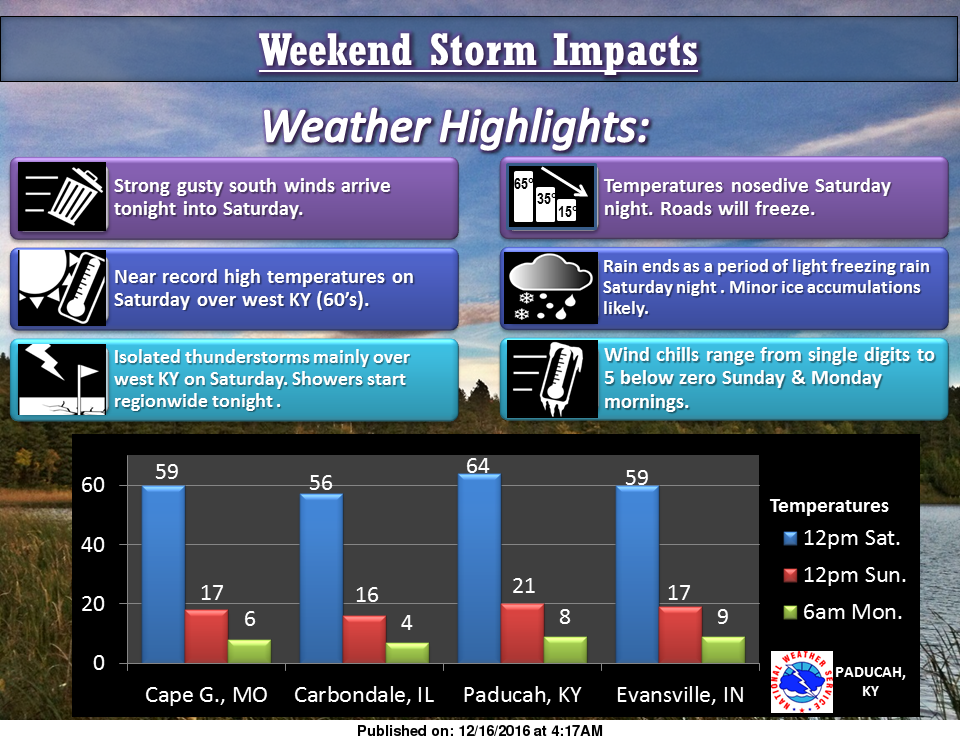
There is a 50% chance of rain on Saturday with a high of 56 degrees with the temperatures nosediving after a very strong cold front comes through the region projected around nightfall.
Precipitation chances will increase to 70% Saturday night, with freezing rain, changing to sleet, then light snow before ending early Sunday morning. The low will be 12 degrees. Total ice and snow accumulation will be around 1/2 inch.
Bitter cold will grip the region with wind chills of -5 to 5 degrees all day Sunday into Monday morning.
Weather conditions will rapidly deteriorate around dark on Saturday night. This is something to stay abreast of if you are out and about. Roads, parking lots and sidewalks will deteriorate quickly. With the gusty winds, Christmas decorations need to be secured.
Franklin-county-news. com will keep you updated on this developing weather situation quickly, as well as any cancellations and school closings throughout the winter months.
Source-Several different products from the National Weather Service in Paducah KY.


Speak Your Mind
You must be logged in to post a comment.