Good Morning. It is going to be a great Super Bowl Sunday with highs in the 50’s.
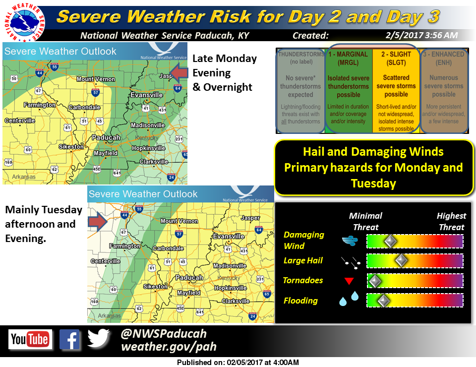
Things will start changing tomorrow. Highs will be in the lower sixties with a chance of afternoon and evening thunderstorms.
With near steady temperatures overnight the first round of probable severe weather will come during those hours, and into Tuesday morning.

TORCON index for tomorrow night. Dr. Greg Forbes, The Weather Channel.
The next wave of Severe weather will be in the afternoon and evening hours of Tuesday.
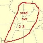
Both days, the Storm Prediction Center has Franklin County and the rest of Southern Illinois in a slight risk for severe weather. The main threat is large hail and damaging thunderstorm winds. At this time the tornado threat is minimal.
Dr Greg Forbes, of The Weather Channel,
TORCON index for Tuesday, Dr. Greg Forbes, The Weather Channel
has the TORCON index of 2 across Southern Illinois for Monday and Tuesday, showing the Tornado threat for the region is minimal at this time.
Behind this weather system, it is supposed to be cooler with highs in the upper 30’s for Wednesday and Thursday, warming to the 50’s by the weekend.
We will keep you updated at franklincounty-news. com of any changing conditions for Monday and Tuesday. There will be real time updates on the Facebook page. The site will be updated frequently.


Speak Your Mind
You must be logged in to post a comment.