SPC image
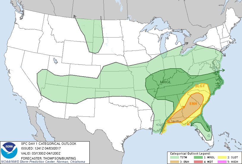
There is a marginal risk of severe weather today for all of Southern Illinois. The tornado threat is near zero. There is a small risk of large hail and damaging winds. Here is the hazardous weather outlook from the National Weather Service of Paducah, KY.
This Hazardous Weather Outlook is for portions of southern Illinois, southwest Indiana, western Kentucky, and southeast Missouri. .DAY ONE…Today and Tonight Scattered thunderstorms will be possible today. Isolated severe thunderstorms with damaging winds and large hail cannot be ruled out, mainly this afternoon. .
DAYS TWO THROUGH SEVEN…Tuesday through Sunday Thunderstorm chances will return on Wednesday. At this time, a few severe thunderstorms cannot be ruled out, especially over southwest Indiana and the Pennyrile region of western Kentucky. Patchy frost will be a possibility Friday night along the I-64 corridor of Illinois and southwest Indiana.
Thunderstorm chances will be 40% this morning increasing to 80% this afternoon and evening. The chance is 60% before midnight tonight.
We will keep you informed if any watches and warnings are issued.
On Wednesday there is also a marginal risk for severe weather for points north and east of a line from Carmi to Effingham. I will keep you updated if the situation warrants.


Speak Your Mind
You must be logged in to post a comment.