by Steve Dunford
 We had two rounds of a couple pretty heavy showers and thunderstorms that crossed the region last night. There was a few reports of limbs down across Franklin County.
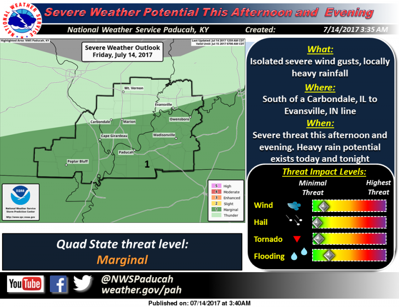
There is a marginal (level one of five) risk for severe thunderstorms for this afternoon and evening south of a Carbondale to Evansville, IN line.
As far as precipitation for the next few hours, there is a line of storms that are stretching from Clinton County through Northern Marion County at this time. They are drifting ESE. If they stay together, they can bring some showers and possible rumbles of thunder to Franklin county.
Below is the Hazardous Weather Outlook and the seven day forecast for Franklin County.
This Hazardous Weather Outlook is for portions of southern
Illinois, southwest Indiana, western Kentucky, and southeast
Missouri.
.DAY ONE…Today and Tonight
There is a marginal risk of severe weather this afternoon and
evening south of a line from Carbondale,IL to Evansville, IN.
Isolated severe wind gusts are possible.
Locally heavy rainfall is possible today and tonight across the
entire area. Flooding of low lying or poor drainage locations are
possible.
.DAYS TWO THROUGH SEVEN…Saturday through Thursday
Thunderstorms are possible Saturday over southern Missouri and
southern Kentucky. Severe storms are not expected, but locally
heavy rainfall is possible.
Thunderstorms are possible along the I-64 corridor on Thursday.
Severe storms are not expected at this time.
Heat index values on Tuesday, Wednesday, and Thursday afternoons
will range from 100 to 105 over much of the area.
.SPOTTER INFORMATION STATEMENT…
Spotters may be activated at isolated locations this afternoon and
evening.
Seven Day Forecast for Franklin County


Speak Your Mind
You must be logged in to post a comment.