 .DAY ONE…Today and Tonight
An isolated thunderstorm chance exists today, mainly this
afternoon and evening. Lightning and heavy rain will be the
primary hazards, should a storm occur.
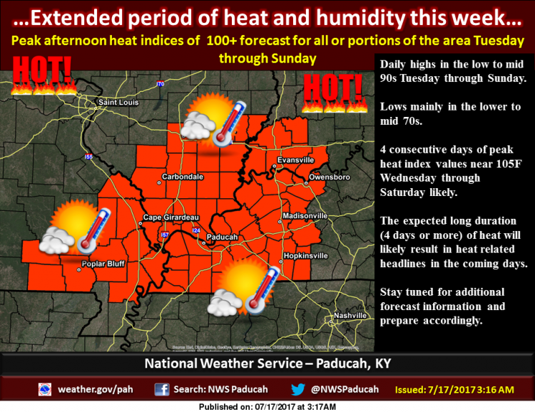
.DAYS TWO THROUGH SEVEN…Tuesday through Sunday
The longest stretch of hot, humid weather this summer is expected
Tuesday through the weekend. Daily heat indices will reach or
exceed 100, and may approach 105 at times.
.SPOTTER INFORMATION STATEMENT…
Spotter activation is not expected.
Detailed Forecast
Today
A 20 percent chance of showers and thunderstorms after 10am. Mostly sunny, with a high near 88. Calm wind becoming west around 5 mph in the afternoon.
Tonight
Mostly clear, with a low around 68. Light north wind.
Tuesday
Sunny, with a high near 92. Light and variable wind.
Tuesday Night
Mostly clear, with a low around 72. Light and variable wind.
Wednesday
Sunny, with a high near 96. West wind 3 to 5 mph.
Wednesday Night
Mostly clear, with a low around 74. Calm wind becoming south southwest around 5 mph.
Thursday
Sunny, with a high near 95. Southwest wind 3 to 6 mph.
Thursday Night
Mostly clear, with a low around 75. South southwest wind around 6 mph.
Friday
Sunny, with a high near 95. South southwest wind 5 to 8 mph.
Friday Night
Mostly clear, with a low around 76. South southwest wind around 8 mph.
Saturday
Sunny, with a high near 94. Southwest wind around 8 mph.
Saturday Night
Partly cloudy, with a low around 75. South southwest wind around 7 mph.
Sunday
Mostly sunny, with a high near 92. Southwest wind 6 to 8 mph.


Speak Your Mind
You must be logged in to post a comment.