by Steve Dunford
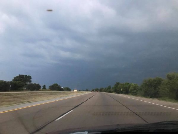
The approaching storm around the New Baden exit on I-64 around 6:45 p.m.. The very dark blue sky could indicate there is some hail within the storms. (Thank you Brent Snyder for allowing me to use the picture.)
I am still tracking a line of severe thunderstorms that will be approaching our area in the next few hours. I am giving a 10:00 p.m. to 12:00 a.m. time frame for the activity to hit Franklin County.
There has been a very large Severe Thunderstorm Warning issued for Madison, St. Clair, Clinton and Bond Counties. It was issued at 6:45 and will be in effect until 8:15. If another warning is issued to the southeast, I will post it on the Facebook page.
There is no indication at this time, the Severe Thunderstorm Watch for the counties north of Route 50 will be extended into points southward.
There is a possibility the storms could lose their punch. Since they are very slow moving, (25 mph.), even if they lose their punch, I am concerned with the possibility of flash flooding.
I will keep you updated as long as the severe threat continues.


Speak Your Mind
You must be logged in to post a comment.