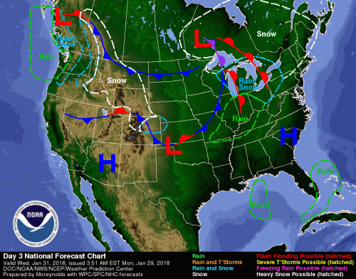
Wednesday’s weather map
This is from Luke Saeger, of The Storm Predictor. “For the last few model runs, the “big snowstorm” is no more. New model data shows,system moving farther south and does not look to impact southern Illinois. If anything changes I will let you know.”
The high will be well above freezing at 42 degrees on Thursday. There is a chance of precipitation on Saturday night, and a chance of snow showers Sunday. -sd
Seven Day Forecast
Tonight
Clear, with a low around 19. North northwest wind 3 to 7 mph.
Tuesday
Sunny, with a high near 38. Light and variable wind becoming south 5 to 7 mph in the afternoon.
Tuesday Night
Mostly clear, with a low around 30. South wind 7 to 14 mph, with gusts as high as 24 mph.
Wednesday
Mostly sunny, with a high near 53. South southwest wind 10 to 15 mph, with gusts as high as 29 mph.
Wednesday Night
A 20 percent chance of rain after midnight. Mostly cloudy, with a low around 39. South southwest wind 5 to 10 mph becoming west northwest after midnight.
Thursday
A 50 percent chance of showers. Mostly cloudy, with a high near 42. North northwest wind 5 to 11 mph.
Thursday Night
Partly cloudy, with a low around 16. North northwest wind 6 to 9 mph.
Friday
Sunny, with a high near 31. North wind around 6 mph becoming light and variable in the afternoon.
Friday Night
Mostly cloudy, with a low around 22. South wind 3 to 7 mph.
Saturday
Mostly cloudy, with a high near 43. South southwest wind 7 to 11 mph.
Saturday Night
A chance of rain and snow showers. Mostly cloudy, with a low around 25. South southwest wind 6 to 9 mph becoming north northwest after midnight.
Sunday
Mostly cloudy, with a high near 32. North wind around 9 mph.
Sunday Night
A chance of snow showers. Mostly cloudy, with a low around 16. North wind 6 to 8 mph.
Monday
Mostly sunny, with a high near 30. West northwest wind 5 to 7 mph.


Speak Your Mind
You must be logged in to post a comment.