It is going to be Sunny and windy today with a high of 31 degrees. The low is going to be 19 tonight with snow moving in during the overnight hours.
Click the following link for the seven day forecast for Franklin County.
http://forecast.weather.gov/MapClick.php?map.x=176&map.y=89&site=pah&zmx=1&zmy=1#.WG0QudQrJxA
Here is a special weather statement issued by the National Weather Service in Paducah KY for Franklin and surrounding counties :
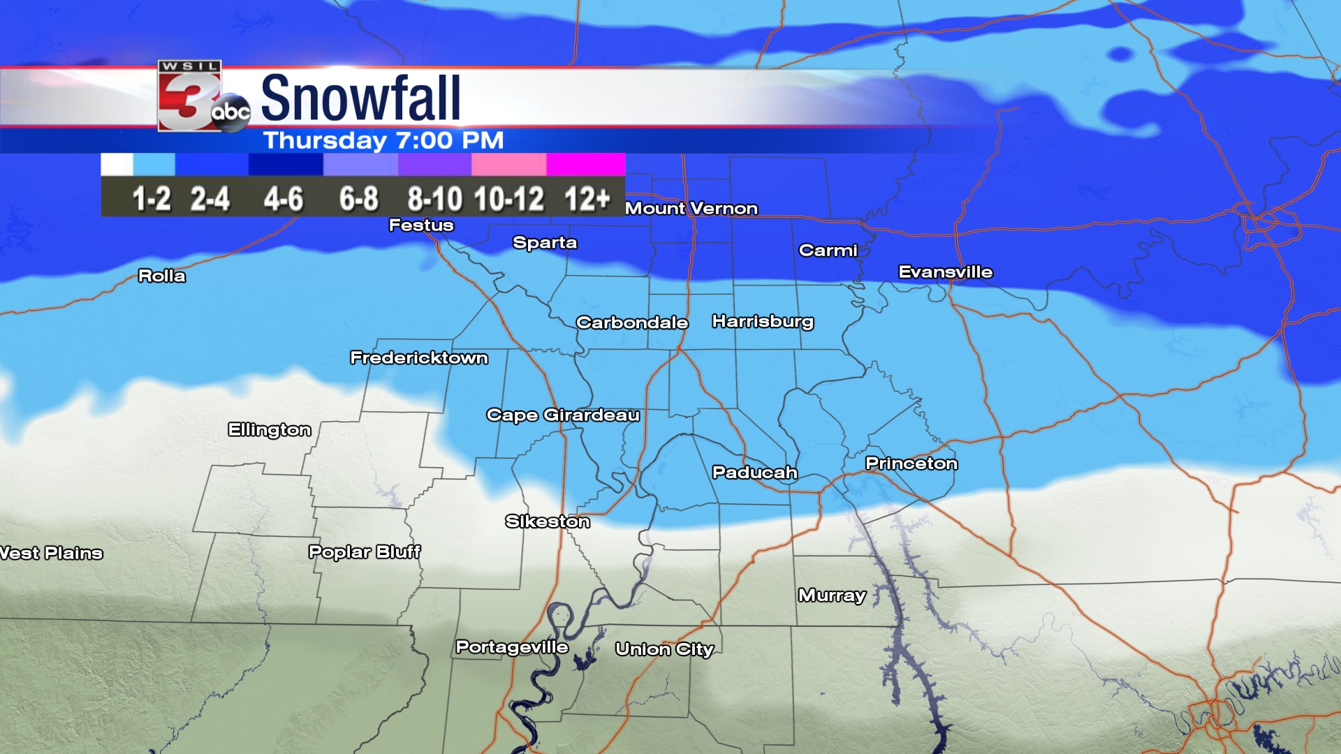
…FIRST ACCUMULATING SNOW OF THE SEASON POSSIBLE THURSDAY…
With Arctic air already in place across the region, an upper-level storm system will produce a swath of light snow, as it swings through our region Thursday.
The initial band of light snow may reach the Interstate 64 corridor of southern Illinois just prior to daybreak Thursday, but the bulk of the accumulating snowfall is expected in the morning hours. 1 to 2 inches of snow is possible across the Interstate 64 corridor of southern Illinois and southwest Indiana.
The snow is expected to taper off quickly from west to east Thursday afternoon. Farther south across the region, a half inch or less is expected, and much of the area may only see a few periods of flurries.
At this time, considerable uncertainty exists with this storm system. On the high end, the potential exists for light accumulations across the entire area, with narrow bands of enhanced snowfall. On the low end, a very minor adjustment could result in nothing but flurries across the area.
With the cold air in place, any accumulations would likely create travel difficulties. Please stay tuned for the latest forecasts and statements on this potential winter storm system from the National Weather Service in Paducah, Kentucky.
Follow franklincounty-news.com for advisory updates and possible cancellations throughout this possible winter weather event.


Speak Your Mind
You must be logged in to post a comment.