by Steve Dunford
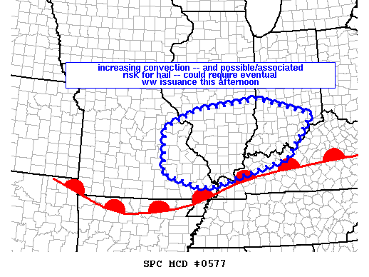 First of all everything from my previous post applies. The Storm Prediction center currently has All of Southern Illinois under a meso (which means Mesoscale Discussion). This is an area the SPC monitors for watch issuance. (See graphic above)
There is a strong possibility a watch will be issued over the next two hours for Southern Illinois. In my opinion, most likely it will be a Severe Thunderstorm Watch. However, I would not be a bit surprised if a Tornado Watch would be issued.
There are a couple cells that is firing in Southeast Missouri. There is one in that has has prompted a Severe Thunderstorm Warning. If it stays together, it has the potential to go through parts of Randolph, Perry, and Jefferson Counties.
I am keeping an eye on a cell that is in Cape county at the time that has the potential to move into Franklin County that could affect some afternoon sporting events. Grant Dade put the track on it, and it has the potential to reach Carbondale at 2:30.
I am watching what this does as it crosses the river. During a severe weather event, please check the Facebook page and your favorite media source. Things develop too quickly to post on the website, but I will make the effort.


Speak Your Mind
You must be logged in to post a comment.