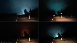
The EF-4 tornado that through Jackson and a small portion of Franklin County on February 28th. (Storm chaser Reed Timmer photo provided to the Paducah NWS)
PADUCAH, KY – The year 2017 was noteworthy for the catastrophic tornadoes and flooding that occurred in the spring. The strongest tornado in the United States in 2017 (through at least Dec. 21) was the EF-4 that passed through Perryville, Missouri on Feb. 28 with peak winds near 185 mph. Historic flooding occurred in southeast Missouri later in the spring, when the Current River rose 8 feet above its previous record. The cities of Van Buren and Doniphan sustained widespread severe flood damage. The winter of 2016-17 was notable for the lack of snow and cold. The biggest event of the summer for some of us was the total eclipse of the sun on August 21. The remnants of four tropical systems affected our region in the summer and early fall. Each system brought heavy rain to parts of our region.
Click on the link below for the ten biggest weather events of the year in the Paducah Forecast Office region. The events are listed in chronological order.


Speak Your Mind
You must be logged in to post a comment.