The Rev. Billy Graham, prominent Christian evangelist, passes at 99


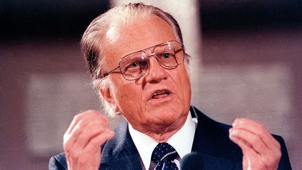
U.S. evangelist Billy Graham spoke in the East Berlin Gethsemane Church in 1990. (Reuters)

MONTREAT, NC – The Rev. Billy Graham , the Christian evangelist whose worldwide crusades and role as adviser to decades of U.S. presidents made him one of the best known religious figures of his time, died Wednesday at age 99 at his home in Montreat, N.C, Todd Shearer of DeMoss Associates told Fox News.

Graham, who had been in ill health for a number of years, was regularly listed in polls as one of the “Ten Most Admired Men in the World.”
Shearer told Fox News that Graham died from “natural causes.”

His Christian crusades took him from the frenzy of Manhattan to isolated African villages and according to the Billy Graham Evangelistic Association website, he preached to more people in live audiences than anyone else in history,  ‘

Please click on the link for the full story from Fox News.

http://www.foxnews.com/us/2018/02/21/rev-billy-graham-prominent-christian-evangelist-dead-at-99-fox-news-confirms.html


Flood watch in effect for all of Southern Illinois until late Satruday night

A Flood Watch is in effect through Saturday night. A very wet pattern will continue with multiple rounds of showers and some thunderstorms with heavy rain through the remainder of the week. Total rainfall of 4 to 7 inches is generally forecast through Saturday night. This may lead to flooding of creeks and streams that feed into already swollen rivers. Standing water may make some roads impassable by the weekend. Remember, if you encounter a water covered road, turn around and find an alternate route. (NWS Paducah)

..FLOOD WATCH NOW IN EFFECT THROUGH LATE SATURDAY NIGHT…

The Flood Watch is now in effect for

* All of southeast Missouri, southern Illinois, southwest Indiana
and western Kentucky.

* Through late Saturday night.

* Multiple rounds of rain, moderate to heavy at times will
increase the risk for areal flooding through the end of the
week, primarily from Thursday night through Saturday night.
Isolated low land and poor drainage areal flooding cannot be
ruled out before then.

* The main flooding concern will be along small streams and creeks
that feed into already swollen rivers across the region.
especially in areas that receive multiple rounds of moderate to
heavy rainfall. Elsewhere, elevated water levels in low lying
and poor drainage areas may lead to standing water across some
roads that typically flood.

PRECAUTIONARY/PREPAREDNESS ACTIONS…

A Flood Watch means there is a potential for flooding based on
current forecasts.

You should monitor later forecasts and be alert for possible
Flood Warnings. Those living in areas prone to flooding should be
prepared to take action should flooding develop.

Hazardous Weather Outlook

This Hazardous Weather Outlook is for portions of southern
Illinois, southwest Indiana, western Kentucky, and southeast
Missouri.

.DAY ONE…Today and Tonight

Rain will continue off and on today through tonight. The highest
rainfall totals today through tonight will be across west
Kentucky. Will monitor this area for isolated standing water
issues.

Temperatures will drop to near 32 degrees today from around Marble
Hill Missouri to Pinckneyville Illinois. This may result in some
light freezing rain mainly on elevated surfaces. Confidence is low
with respect to potential impacts on road surfaces. We will
monitor conditions through the day.

.DAYS TWO THROUGH SEVEN…Thursday through Tuesday

Multiple rounds of showers and thunderstorms will bring periods of
heavy rain to the entire region Thursday night through Saturday
night. The flooding concern will increase with each round of heavy
rainfall, culminating with the cold frontal passage Saturday night.
Please refer to the Flood Watch for more details.

The potential for strong thunderstorms late Saturday afternoon into
Saturday night will also need to be monitored closely. The greatest
limiting factor may be the availability of surface based instability
with the amount of cloud cover and rain forecast.

Continue to monitor the latest river flood warnings for impact
messaging and forecast stage information.

.SPOTTER INFORMATION STATEMENT…

We request spotters report rainfall totals along with any
observed area flooding over the next several days.

Seven Day Forecast

Today Rain. High near 38. North wind 10 to 13 mph, with gusts as high as 25 mph. Chance of precipitation is 90%.

Tonight Rain, mainly before 5am. Temperature rising to around 39 by 4am. Northeast wind around 11 mph, with gusts as high as 18 mph. Chance of precipitation is 100%.
Thursday A 20 percent chance of rain before noon. Cloudy, with a high near 50. Northeast wind 5 to 9 mph.
Thursday Night Showers likely, then showers and possibly a thunderstorm after midnight. Some of the storms could produce heavy rain. Low around 46. East northeast wind 5 to 7 mph becoming west southwest after midnight. Chance of precipitation is 100%.
Friday Showers and possibly a thunderstorm before noon, then a chance of showers. Some of the storms could produce heavy rain. High near 57. West northwest wind around 6 mph becoming north northeast in the afternoon. Chance of precipitation is 80%.
Friday Night Showers and possibly a thunderstorm. Some of the storms could produce heavy rain. Low around 50. Light and variable wind becoming east southeast 5 to 7 mph after midnight. Chance of precipitation is 90%.
Saturday Showers and possibly a thunderstorm. Some of the storms could produce heavy rain. High near 64. East southeast wind 7 to 13 mph becoming south in the afternoon. Chance of precipitation is 90%.
Saturday Night Showers and possibly a thunderstorm before midnight, then a chance of showers. Some of the storms could produce heavy rain. Mostly cloudy, with a low around 44. South wind 13 to 15 mph becoming west after midnight. Winds could gust as high as 25 mph.
Sunday Mostly sunny, with a high near 54. West wind 7 to 15 mph, with gusts as high as 24 mph.
Sunday Night Mostly clear, with a low around 36. Northwest wind 5 to 7 mph becoming east after midnight.
Monday Sunny, with a high near 56. East southeast wind 5 to 7 mph becoming north in the afternoon.
Monday Night Mostly clear, with a low around 37. East southeast wind 5 to 7 mph.
Tuesday Sunny, with a high near 57. East wind 6 to 8 mph becoming south southeast in the morning.

Benton Police make three recent arrests

BENTON – On February 16th, 2018 Benton Police conducted a traffic stop at the intersection of East Main and Stuyvesant Street. Through investigation, police arrested Christina L. Walden, age 39, of Benton for driving while license revoked. Walden was transported to the Franklin County Jail for further processing.

On February 17th, 2018 Benton Police arrested Dennis C. Donaldson, age 48, of Benton on an active Franklin county warrant for failure to appear. Donaldson was transported to the Franklin County Jail for further processing.

On February 19th, 2018 Benton Police conducted a traffic stop in the 800 block of Frisco Street.
Through investigation, police arrested Robert L. Plumlee, age 23, of Benton for driving while license revoked. Plumlee was charged and transported to the Franklin County Jail for further processing.

The public is reminded the alleged are presumed innocent until proven guilty by a court of law.

Wind advisory issued until 6:00 p.m.


The National Weather Service in Paducah has issued a Wind Advisory, which is in effect until 6 PM CST this evening for the following counties,  ALEXANDER … FRANKLIN … JACKSON … JEFFERSON … PERRY … UNION.

* TIMING…This afternoon.

* WINDS…South southwest winds will gust 40 to 50 mph.

* IMPACTS…Vehicular traffic, especially for high profile
vehicles, will be affected with rough driving conditions. Mobile
homes and outdoor construction work will be affected. Choppy
waves on area water bodies will make boating hazardous,
especially on Rend Lake.

PRECAUTIONARY/PREPAREDNESS ACTIONS…

A wind advisory is issued when sustained winds are expected to
reach 30 mph or greater for longer than one hour…or wind gusts
are expected to reach 40 mph for any duration.

Hazardous Weather Outlook

.DAY ONE…Today and Tonight

There is a chance of thunderstorms tonight, with heavy rainfall
possible, mainly after midnight.

South winds may gust around 35 mph or slightly higher today.

.DAYS TWO THROUGH SEVEN…Wednesday through Monday

The rains late Tuesday through Wednesday night will likely set the
stage for the possibility of areal flooding mid to late week, as
rounds of widespread showers and a few thunderstorms are expected,
producing multiple periods of heavy rainfall across the region
Thursday night through Saturday night. The flooding concern will
increase with each round of heavy rainfall, culminating with the
cold frontal passage Saturday night. A few strong storms cannot be
ruled out Saturday.

.SPOTTER INFORMATION STATEMENT…

Rainfall measurements from our spotters are requested, along with
any reports of observed flooding later in the week.

Hydrologic Outlook

The forecast weather pattern this week continues to support
multiple rain episodes, that will likely result in several inches of
rain. An initial round is expected from late tonight through
Wednesday night. Additional rains will come later in the week,
especially from Thursday night through Saturday night.

The main concern with this week`s rainfall will be the potential
for additional flooding of rivers and their tributaries. Flooding of
low land and poor drainage areas will become likely mid to late
week. We may see some flooding develop on roads that typically
experience water problems during longer duration heavy rain events,
again from mid to late week.

Stay tuned for later statements and updates.

Seven Day Outlook

This Afternoon
A 40 percent chance of showers, mainly after 4pm. Cloudy, with a high near 73. Breezy, with a south wind 16 to 21 mph, with gusts as high as 37 mph.
Tonight
Showers and possibly a thunderstorm. Some of the storms could produce heavy rainfall. Patchy fog after 10pm. Low around 37. South wind 13 to 16 mph becoming north northwest after midnight. Winds could gust as high as 26 mph. Chance of precipitation is 100%.
Wednesday
Showers. High near 39. North wind 10 to 13 mph, with gusts as high as 21 mph. Chance of precipitation is 100%.
Wednesday Night
Showers. Low around 37. Northeast wind 8 to 10 mph. Chance of precipitation is 80%.
Thursday
A 30 percent chance of showers, mainly before noon. Cloudy, with a high near 51. Northeast wind 5 to 8 mph.
Thursday Night
Showers likely, then showers and possibly a thunderstorm after midnight. Low around 48. East wind around 6 mph becoming south after midnight. Chance of precipitation is 80%.
Friday
Showers and possibly a thunderstorm before noon, then a chance of showers. High near 58. South southwest wind around 6 mph becoming north northeast in the afternoon. Chance of precipitation is 90%.
Friday Night
Showers likely, then showers and possibly a thunderstorm after midnight. Cloudy, with a low around 49. East wind 5 to 10 mph becoming south after midnight.
Saturday
Showers and possibly a thunderstorm. Cloudy, with a high near 62. South southwest wind 8 to 10 mph.
Saturday Night
Showers likely and possibly a thunderstorm before midnight, then a slight chance of showers. Mostly cloudy, with a low around 41. South southwest wind 9 to 14 mph becoming west after midnight. Winds could gust as high as 22 mph.
Sunday
Mostly sunny, with a high near 54. West northwest wind 6 to 14 mph, with gusts as high as 23 mph.
Sunday Night
Mostly clear, with a low around 36. West southwest wind around 6 mph becoming southeast after midnight.
Monday
Sunny, with a high near 57. South southeast wind 5 to 10 mph becoming west southwest in the afternoon.


Drug sweep at FCHS this morning

Press Release by Matt Donkin, District 168 Superintendent 

WEST FRANKFORT – As part of their regular services, the Illinois State Police, working with the West Frankfort Police Department, offer Drug dog sweeps as part their prevention programs.

These visits are unannounced to school officials as to better preserve their effectiveness. One of those surprise visits is happening this morning at FCHS.

This is part of our continued cooperative work to keep our kids and our schools safe. There is no threat that we are aware of today. We also hope to have a clean sweep and then go about our regular day.

Superintendent Donkin thanks  everyone in advance for their cooperation as we work through the tough and challenging issues that we are facing.

Makandastrong fundraiser

Makanda Williams -WSIL-TV photo

BENTON – On May 11th, 2017 Makanda Williams was diagnosed with diffuse intrinsic poline glioma, or DIPG, a rare malignant brain tumor found in children with no effective treatment in the U.S.

“In Mexico they’re using 8-10 different chemo therapy drugs that are all FDA approved. Every three to four weeks right now we travel, we’re gone three to four days at a time, without travel expenses, the treatment itself is 16-thousand dollars.” Carlton said.

Makanda’s mom plans to hold one of their biggest fundraisers on February 25th at the Benton Eagles. Dozens of local businesses have donated services and goods to the event.

Please click on the link for the full story from Taylor Vessel of WSIL-TV

http://www.wsiltv.com/story/37540950/makandastrong-fundraiser


Herrin Police: 12-year-old threatens girls with toy handgun in Herrin

Juvenile Suspect is from West Frankfort

WSIL image

HERRIN — A southern Illinois mother speaks out after a 12-year-old girl reportedly threatened her daughter with a gun, which appears to have been a toy.

Nicole Lacey is calling for the suspect to be held accountable as the investigation heads toward the Williamson County State’s Attorney’s office.

“My daughter is 13 years old and I have never been more terrified to send her anywhere,” Lacey said. “I don’t care if it was a fake gun, a real gun, the terror that she inflicted in my child that night was real.”

Please click on the link for the full story and video from WSIL-TV.

http://www.wsiltv.com/story/37534637/police-12-year-old-threatens-girls-with-toy-handgun-in-herrin

FROM THE MARION POLICE: WANTED-ARMED AND DANGEROUS

MARION -The Marion Police Department NEED YOUR HELP in locating this person. Lemont P. Brinson, (male, 5ft.9in. 140 lbs) is currently WANTED-ARMED AND DANGEROUS in connection with multiple weapons offenses in Marion, IL (Williamson County).

If you see or know the whereabouts of Lemont P. Brinson, please contact the Marion Police Department immediately at (618) 993-2124 or notify your local police agency.

Please do not approach Brinson. Notify police immediately!!

THANK YOU FOR YOUR HELP AND STAY SAFE OUT THERE!!

Coroner Marty Leffler Confirms 2nd Weekend Traffic Crash Fatality

WHITTINGTON – Franklin County Coroner Marty Leffler has confirmed that a 27-year-old male died in a single car accident on Sunday, February 18, 2018. A 9-1-1 call went out after 5:15 a.m. by a passerby who said there was a single vehicle overturned off of the roadway on Route 37 North, near Whittington, just South of the Franklin-Jefferson County line road. It appears the vehicle was traveling Northbound on Route 37 and failed to negotiate a curve, striking a driveway culvert and overturning. The 27-year-old male was found ejected from the vehicle. He was transported by ambulance to the Franklin Hospital Emergency Room where he was pronounced deceased.

The Franklin County Sheriff Department is investigating the accident. An autopsy is scheduled for Tuesday.

This is the second single car motor vehicle accident, with a fatality in the past 26 hours.

No further information is available at this time.

Students earn high marks at WYSE Academic Challenge

INA – Over 150 students from 10 area high schools competed in the 2018 Worldwide Youth in Science and Engineering (WYSE) Academic Challenge Regional in the last two weeks. Eight of the schools met on Rend Lake College’s campus on Wednesday, Feb. 7 to participate; however, due to weather, two other schools held make-up events on later dates.

During the WYSE Academic Challenge, schools with similar enrollment compete against one another in divisions. Christopher High School, Wayne City High School, Zeigler-Royalton High School, Sesser-Valier High School, Waltonville High School, and Webber Township High School make up Division 300. Division 700 consists of Benton Consolidated High School, Pinckneyville Community High School, and Hamilton County Senior High School. The lone Division 1500 school is Mt. Vernon Township High School.

Each student who competes in the WYSE Academic Challenge completes two exams in pre-selected subjects. They can choose from biology, chemistry, computer science, engineering graphics, English, math, or physics. Below are the regional results, followed by team photos. Students who qualify for the WYSE Sectional will compete at Southern Illinois University Carbondale on Wednesday, March 14. The Illinois State Finals will be held April 16-19 at the I-Hotel and Conference Center in Champaign.


Benton, West Frankfort, Illinois News | Franklin County News