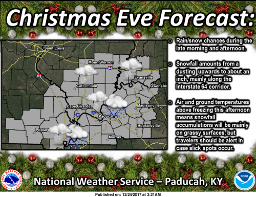
Special Weather Statement
..Light Dusting of Snowfall Christmas Night…
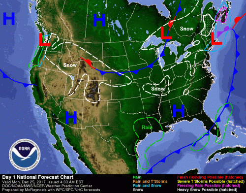
A light dusting of snowfall is forecast with spotty snow showers
Christmas night. A half inch or less is expected, but with it
falling in much colder temperatures, this could create a few slick
spots on roads and walkways.
Christmas night travelers are advised to slow down, allow
a little extra time to turn or stop, and use your low beam
headlights to increase your visibility to others.
Hazardous Weather Outlook
.DAYS TWO THROUGH SEVEN…Tuesday through Sunday
A chance of light snow or flurries is forecast across all or a
part of the area Tuesday, Thursday afternoon and evening, Friday
night, and late Saturday night into Sunday. However, the potential
for impactful accumulation remains low at this point.
Seven Day Forecast
Christmas Day
Mostly cloudy, with a high near 31. West wind 6 to 8 mph.
Tonight
A 30 percent chance of snow showers, mainly between 9pm and 3am. Cloudy, with a low around 21. South southwest wind around 5 mph becoming calm in the evening.
Tuesday
Mostly cloudy, with a high near 26. Light north northeast wind increasing to 5 to 9 mph in the morning.
Tuesday Night
Mostly cloudy, with a low around 9. Wind chill values as low as zero. North wind 7 to 9 mph.
Wednesday
Sunny, with a high near 20. North northeast wind 7 to 9 mph.
Wednesday Night
Partly cloudy, with a low around 11. Northeast wind 6 to 8 mph.
Thursday
Mostly cloudy, with a high near 28. East northeast wind around 6 mph becoming calm in the afternoon.
Thursday Night
Mostly cloudy, with a low around 18. Calm wind becoming northwest around 5 mph after midnight.
Friday
Partly sunny, with a high near 31. West northwest wind around 6 mph.
Friday Night
A slight chance of snow after midnight. Mostly cloudy, with a low around 15. Northwest wind 5 to 7 mph.
Saturday
A slight chance of snow. Partly sunny, with a high near 22. North wind around 7 mph.
Saturday Night
A chance of snow. Mostly cloudy, with a low around 12. North northeast wind around 7 mph.
Sunday
A chance of snow. Mostly cloudy, with a high near 23. North wind around 8 mph.