
MLB Commissioner Rob Manfield (left) and Cardinal CEO Bill DeWitt (right) at an MLB press conference in 2014 (AP file photo)
Benton, West Frankfort, Illinois News | Franklin County News
Newspaper covering Franklin County, Illinois
MLB Commissioner Rob Manfield (left) and Cardinal CEO Bill DeWitt (right) at an MLB press conference in 2014 (AP file photo)

Graphic from KFVS 12 Meterologist Bryan McCormick’s FB page
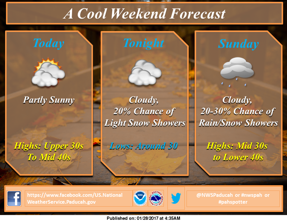
It is going to be a very mild first three days for the week for late January. Today it is sunny for highs in the upper 40’s to around fifty. Lows should be in the mid thirties.
There should be a cooling trend start on Thursday, with highs in the upper 30’s and lows in the mid twenties.
There is a slight chance of snow on Thursday night, and a good chance of snow on Saturday night, into Sunday.

President Trump with Mike Pence far right with White House Staff signing executive orders on Saturday (AP Photo)

A man takes a picture of a giant banner on a building congratulating U.S. President-elect Donald Trump in Jerusalem, January 20, 2017 REUTERS/Ammar Awad/File Photo
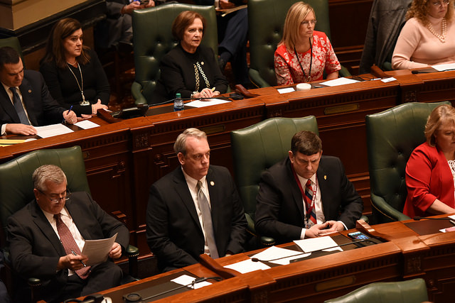
Dave Severin (middle to the right) in the general assembly-State Representative Dave Severin’s website
 There is a small chance (20% – 30 %) of light snow coming in the forecast after midnight tonight and ending as flurries tomorrow evening. Little or any snow accumilation is expected at this time.
Here is the latest Hazardous Weather Outlook issued by the National Weather Service in Paducah, KY
.DAY ONE…TODAY AND TONIGHT A SMALL CHANCE OF LIGHT SNOW SHOWERS IS FORECAST FOR ALL OF SOUTHERN ILLINOIS…SOUTHWEST INDIANA AND MUCH OF WEST KENTUCKY AFTER MIDNIGHT. AT THIS TIME…ACCUMULATIONS ARE NOT EXPECTED.
.DAYS TWO THROUGH SEVEN…SUNDAY THROUGH FRIDAY A SMALL CHANCE OF LIGHT SNOW SHOWERS IS FORECAST FOR AREAS ALONG AND EAST OF THE MISSISSIPPI RIVER SUNDAY, AND FOR PORTIONS OF SOUTHWEST INDIANA AND WEST KENTUCKY SUNDAY EVENING.
VERY MINOR ACCUMULATIONS WILL BE POSSIBLE, ESPECIALLY ACROSS SOUTHWEST INDIANA AND THE PENNYRILE REGION OF WEST KENTUCKY IN THE MORNING AND EVENING HOURS. MOST LOCATIONS ARE LIKELY TO SEE ONLY A FEW PERIODS OF FLURRIES. SIGNIFICANT IMPACTS ARE NOT EXPECTED AT THIS TIME.
LIGHT SNOWFALL IS POSSIBLE AGAIN THURSDAY NIGHT AND FRIDAY MORNING. IMPACTS…IF ANY…ARE EXPECTED TO BE MINIMAL.
Highs are supposed to be in the 40’s and lows will be in the 20’s throughout the forecast period.
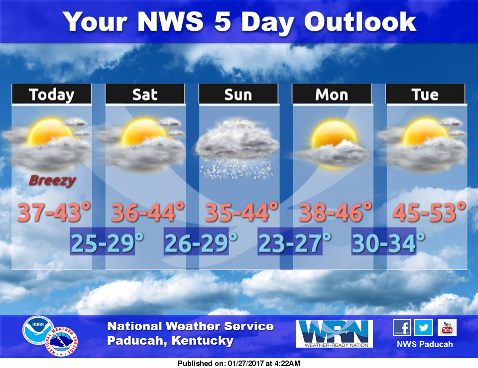 There is a 20% chance of snow on Sunday. Most models at this time are showing flurries to a dusting at most. There should be a cooling trend late next week, with highs in the 30’s and lows in the 20’s.

Former Democratic presidential candidate Hillary Clinton, who in this study received 81% of the voting illegal immigrants. (Evan Vucci -AP Photo)
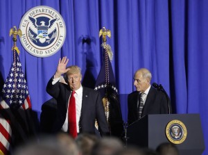
President Donald Trump, followed by Homeland Security Secretary John F. Kelly, waves as he steps off stage after speaking at the Homeland Security Department in Washington, Wednesday, Jan. 25, 2017. (AP Photo/Pablo Martinez Monsivais)