by Steve Dunford
For the most part, the heavy rains have came to a stop. Runoff will be the major problem. Here is a link to the National Weather Service radar in Paducah.
https://radar.weather.gov/radar.php?rid=pah&product=N0R&overlay=11101111&loop=no
The Flash Flood Warning is still in effect until 7:00 p.m. My speculation is for the runoff. The Storm Prediction center has dropped the marginal threat for severe weather.
No matter your age, we will be talking about the Great Flood of 2017 for the rest of our lives.
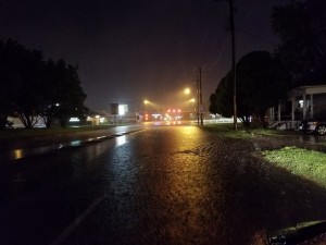
Several roads were flooded throughout the county. This is Route 37 just south of West Frankfort before it was closed for several hours. (WSIL image)
Logan road has opened back up, with country club road in West Frankfort. Route 37 between West Frankfort and Johnston City is now open. I am unsure between Benton and West Frankfort and Johnston City and Marion.
When Franklin County Management Agency updates road closings on their website. I will share again.
I was in contact with the National Weather Service in Paducah Friday. I have talked to them about getting NWS chat, which I can get more information during severe weather events. If I am issued access, I will be able to give the heads up on more things. If I am not approved I understand totally. It might be available to only very large media sources, such as TV stations.
One meteorologist in the Paducah office that has been an encouragement to me is Robin Smith (Smitty). I thought I went overboard posting during the Sectional Tournament tornado outbreak (my name for it), I thought I made a post that might have caused panic. I said a long track tornado was cutting through Franklin County. He told me that it was showing on radar, and could have dropped a twister anytime. This made me feel better.
I haven’t spoke to FCEMA director Ryan Buckingham, but the information that he provided during this event, was outstanding. The videos pinpointing Franklin County has been my goal as well during Severe Weather Events.
Channels three, six, and twelve did an outstanding job covering this event. Grant Dade, Jim Rasor, and Jennifer Rukivina need to be proud of their weather teams. We have top notch meteorologists in this market.
A big shout out goes to the dispatchers of the Franklin County Sheriff’s department, West Frankfort, Benton, and West City PD, and Central Dispatch for letting me bug them in the middle of this event. I know they were overwhelmed, but they gladly provided me information to pass on to you.
Dad needs to brag here. I am going to start sharing much more information from my son Andrew Dunford. He pinpointed to me in a PM this event will be over at 2:30. It was prom weekend for him. He spent several hours working for FCEMA this weekend as well. Hi made me proud.
Several of you have encouraged me to start sharing my opinions on severe weather events. Keep in mind they are opinions not the gospel. Thank you for your confidence. You showed it by your visits to the site.
As a member of the media, this was my first large scale disaster I have covered. Yesterday was emotional draining to me, especially seeing posts on social media of friends their property might be in trouble.
Covering news, sports an weather is right up my alley. Thank you to Jim Muir for taking a chance on me.
Most of you all know that I struggle with my health, and severe weather is rough on me. Thank you Lord for most of all sustaining me so I can give you vital information.
Why this storm fell apart? People were on their knees at the altar of a lot of churches praying for the rain to stop. God heard our prayers.
I am the bearer of good news in this post. I hope I can for several days to come.
 The National Weather Service in Paducah Kentucky is extending the Flash Flood Warning for Franklin and Several Surrounding counties until 5:45 P.M. Here is the Warning text below.
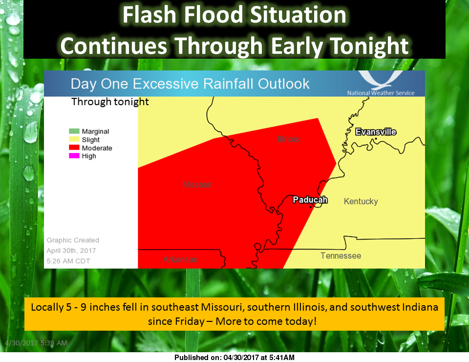
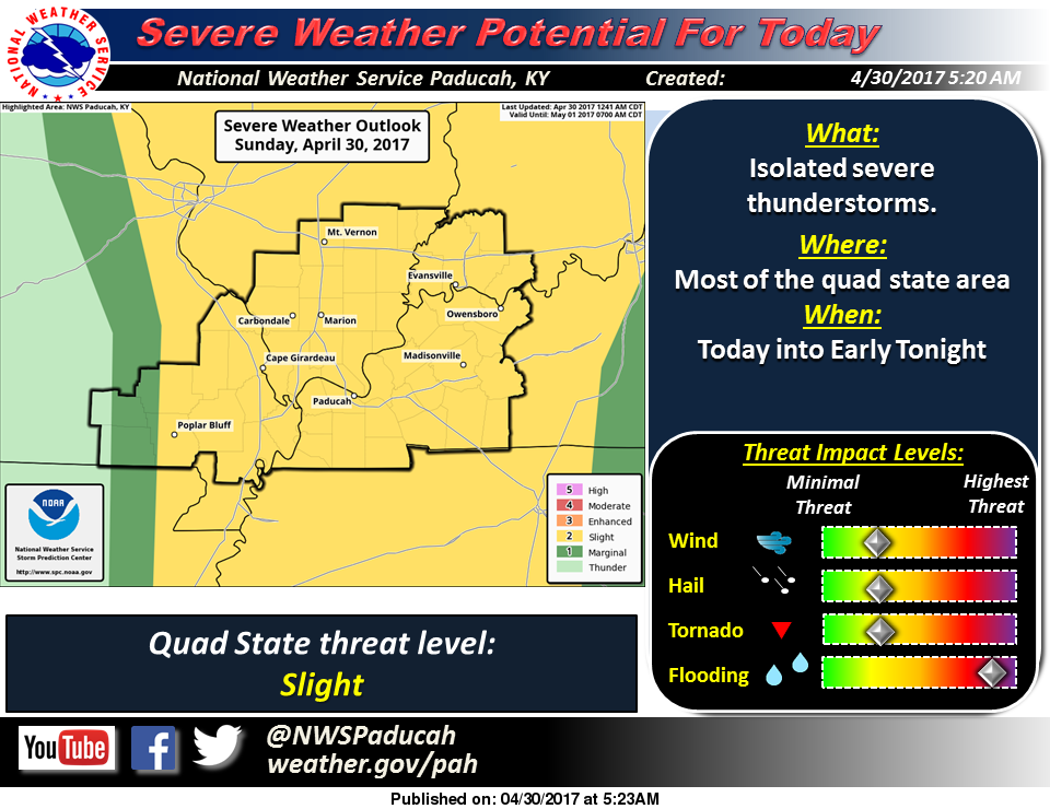 Here in Franklin County we will still be under a flash flood warning until 12:45 p.m. this afternoon. That is likely to be extended. We are supposed to get an additional 1″-3″ inches of rain on top of the 10+ inches we have received already.
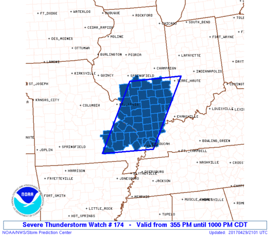 URGENT – IMMEDIATE BROADCAST REQUESTED Severe Thunderstorm Watch Number 174 NWS Storm Prediction Center Norman OK 355 PM CDT Sat Apr 29 2017
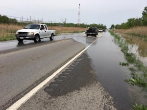
 There was widespread flooding across Southern Illinois including the southern part of Franklin County. Please see the recent story that I just completed about it.